![]()
![]() CV
CV
![]() Cycling
Cycling
![]() Recumbents
Recumbents
![]() Unicycling
Unicycling
![]() Juggling
Juggling
![]() Other Links
Other Links
![]()
|
|
||
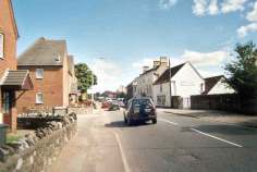
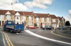 I have to turn right onto the busy A420. This is a lot easier during the school holidays, when I don't have to contend with the extra motor traffic of the school run. |
 This is what I'm turning into. The cars are queueing at 3-way traffic lights. Invariably I can only turn when they're red. |
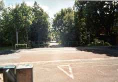
 After the lights I approach the Ring Road crossing. This is a very busy roundabout... |
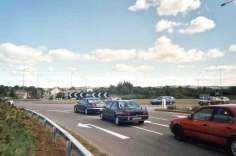 ... made much more difficult and dangerous by the bushes that some bright spark thought to plant on the approach, restricting views of traffic from the right. The alternatives are subways on either side - a great way to make the journey longer and maybe pick up a puncture. |
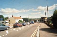
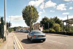
 After the roundabout, I ride along Warmley High Street. It's slightly uphill, but with a clear road I'll do 26mph+ along here. Usually cars get in the way and I'm lucky to do 20mph. |
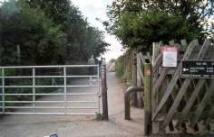
 I turn right onto the cyclepath at this toucan crossing, where the path crosses Warmley High Street. This is the one place where I'll jump a red light - I've suggested green filter arrows for cyclists, but the council wasn't convinced. |
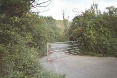
 There used to be barriers like this at all the major cyclepath access points. They were there to keep motorcyclists out, but caused much more inconvenience to legitimate users. Thankfully most, including this one, were removed towardsthe end of 2001. |
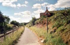
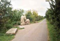 Cyclepath art. This sculpture is also a drinking fountain for filling bottles. It's a bit too close to home to be much use to me, but it marks the halfway point of the cyclepath and is a great idea. |
 Approaching Victoria Road, and you might just make out another barrier coming up in the centre of the picture. This one is still there, forcing me to dismount... |
 ... then another one on the other side of the road. I don't know how the guy I sometimes see on a handcranked recumbent trike manages. (Actually there are radar gates here for disabled access, but they're often chained shut.) |
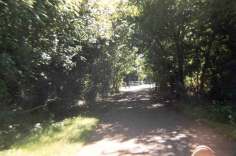
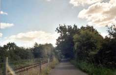
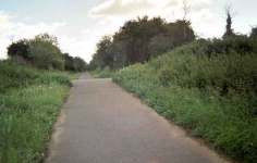
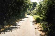
 The cyclepath runs along an old railway route. Part of the railway has been rebuilt by local steam enthusiasts and runs alongside the path. It starts just under this bridge. |
 The path narrows dangerously for a couple of hundred yards when the railway starts. This section is also particularly bad for broken glass, with kids dropping bottles from the bridges. |
 Speed bumps ahead. The path bisects a housing estate with 2 schools on the left. There's a crossing point here, heavily used by children on their way to school. Bollards were installed here on 9 October 2001, just to make life more interesting. |
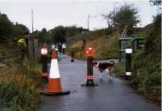 The bollards, complete with a traffic cone on the left (because the contractors damaged the path surface) and a loose dog on the right. Loose dogs represent the greatest hazard on the cyclepath for cyclists. |
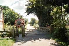
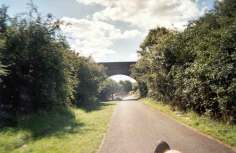
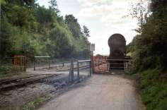 When I reach Bitton Railway Yard, I have to cross the railway. The path used to have "Cyclists Dismount" painted on it (the resort of a local authority that can't be bothered to build or maintain a section of path properly), but it's worn away and I always ignored it anyway. |
 I have to turn at a right angle on each side of the railway. The gates are a little over 3' wide. It's an interesting challenge on a recumbent where the front wheel (and hence the steering) is 2' behind the bottom bracket, but I've got pretty good at it. |
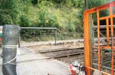
 Bitton Station car park, and the fourth of 5 barriers on my commute has thankfully now been removed. |
 As has this one, rejoining the cyclepath on the other side of the car park. Soon after this the local authority changes from South Gloucestershire to Bath & North East Somerset. The path is much better maintained from here on (the vegetation gets cut and the leaves swept regularly). |
 This section was closed for 5 days at the beginning of the 2001 foot & mouth outbreak. When it was reopened, extra signs were posted asking people to keep to the tarmac and keep all dogs on leads. With their usual routes closed, people came from miles around to ignore the signs and let their dogs run free. |
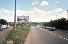
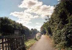
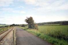 This bit's along an embankment and is pretty exposed once the trees run out. The prevailing wind is from the right. |
 Over the River Avon. On really windy days (maybe 2 or 3 times a year) I might have to get off and push across this bridge. |
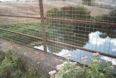
 The fields on either side are above the level of the path. There's a hump ahead to allow tractors and livestock to pass between them. Because there's a slight gradient, after heavy rain a deep puddle builds up on the far side of this hump. |
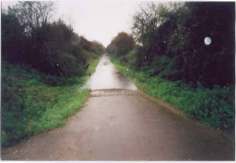 Like this one, in winter 2000/2001. This puddle came up to the bottom bracket on my mountain bike, making it 11" deep. The puddle lasted up to 2 weeks at a time and reappeared several times. |
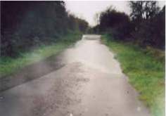 The same puddle from the other end. At my suggestion the council laid a pipe under the hump at one side during June 2000, to drain the water. I suspected they may have positioned it too high, which was confirmed on 26/10/01. |
 Leaving the path at Saltford I have to squeeze through the gap at the left of this gate. It's not usually a problem, unless some thoughtless dog walker has blocked it with his car. |
 Onto Avon Lane. Ironically this downhill section is the slowest part of the ride. Because it's down a narrow, twisty lane, I want to make sure I can stop if I meet something coming the other way. Pity the few motorists I meet along here don't seem to understand the concept. |
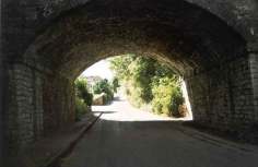 Under the bridge and up the hill, which is a lot steeper than you can see from this picture. |
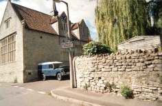 I turn into the car park... |
 ... and lock my bike up, out of view of the road and under the watchful eye of the office CCTV. |
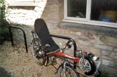
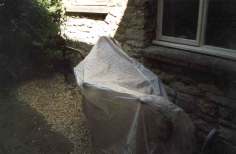 Then sling the cover over it. I used to have to clean and relube my mountain bike chain 2 or 3 times a week in the winter. Then I bought the cover (£5 from Argos) and this immediately dropped to once every 2 or 3 weeks. |
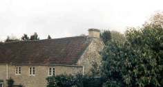 The view from my office window. |
|
This page was inspired by Simon Mason's Virtual Commute |
Nigel Jones' Bath-Bristol pictures
Danny
![]() CV
CV
![]() Cycling
Cycling
![]() Recumbents
Recumbents
![]() Unicycling
Unicycling
![]() Juggling
Juggling
![]() Other Links
Other Links
![]()
![]()
Note on browser compatibility - I hope that this site will be easily accessible in all browsers. If you experience any problems viewing this site, please let me know what the problem is, what browser you're using and, if possible, where I can obtain a copy for testing.
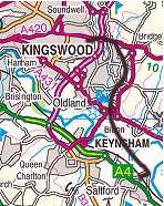 My daily cycle commute is shown by the black line. It is a little over 5 miles (4